Total Solar Eclipse 29 March 2006
Sahara in Southern Libya
DATA and MAPS
|
Observation Place |
N
24o 31.520' [1] E
18o 0.019' Altitude
440 m |
|
Eclipse Time |
1st contact 10:56 [2] 2nd contact 12:14:20 3rd contact 12:18:27 4th contact 13:39 Totality 4:07 67 o above horizon during totality |
|
Sun Photography |
Digital mirror reflex camera Olympus E-500 [3]. Zoom lens 40-150 mm (150 mm used); with a 1.4x tele converter a
focus length of 210 mm could be used. Resolution 3200x2400 pixel gives a sun diameter of about 350
pixel. Processing by Photoshop software only for contrast and
brightness. |
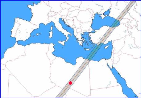
Generated by software Win-Eclipse [2]. The red dot marks the
observation place.
|
[1] The observation place is located in
Southern Libya, about 50 km South-South-East from the famous volcano crater Waw
an Namus ("mosquito crater") in a very flat, stony extreme
desert. According to Espenaks
data the observation place is within 1 km of the central line. Distance to
the border of Chad Republic is about 190 km. [2] Win-Eclipse software by H.
Scsibrany (Vienna, Austria). [3] This equipment cannot be recommended for pictures from
total solar eclipses because of severe focusing problems. |
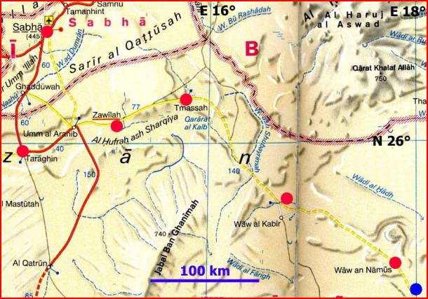
Red dots: Places on the trip, blue dot: eclipse observation place
Libya from 1200 km (vertical view, 1430
km wide, 1160 km high,). Tripoli - Sebha city: 670 km (1 hour flight). Sebha
city - Tmissah: 280 km paved road. Tmissah ("last" village) -
Observation Point: 300 km (1.5 days, no roads). Tripoli - Namus Crater: 1000
km.
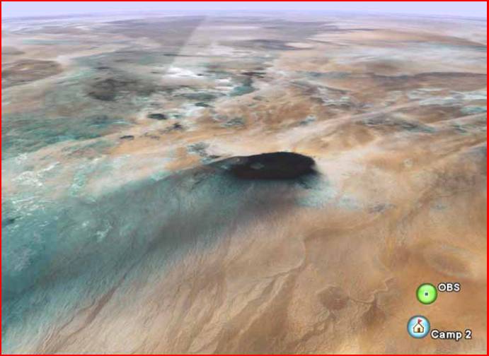
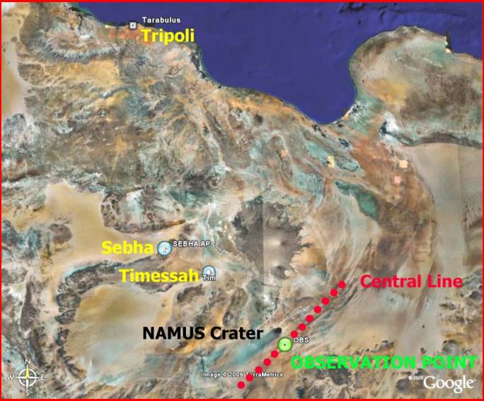
Waw an Namus (Mosquito Crater) and area of Observation Point (tilted view, in foreground 60 km wide, at the position of the crater
115 km wide). The black ash area has a diameter of about 20 km. The crater
(caldera with lakes and central mountains, not visible) has a diameter of about
4 km. The ash tail spreading out to the Southwest has a length of about 160 km.
OBS, observation
point very near to central line; Camp 2, large, dusty, and noisy Eclipse Camp; both about 50 km from the
crater.